
PERPUSTAKAAN STPN
 | PEMBANGUNAN SISTEM INFORMASI KEARSIPAN UNTUK PENGELOLAAN GAMBAR UKUR (Studi di Kantor Pertanahan Kabupaten Lombok Utara) - STPN Yogyakarta - 2015 - Pembangunan Sistem Informasi |
 | PELAKSANAAN KEGIATAN INVENTARISASI PENGUASAAN PEMILIKAN PENGGUNAAN DAN PEMANFAATAN TANAH DI KABUPATEN DOMPU PROVINSI NUSA TENGGARA BARAT (Studi di Kelurahan Kandai Satu Kecamatan Dompu dan Desa Bara Kecamatan Woja) - BPN RI STPN - 2015 |
 | PELAKSANAAN PENDAFTARAN TANAH SISTEMATIK MELALUI PROGRAM LAND MANAGEMENT AND POLICY DEVELOPMENT PROGRAM (LMPDP) DI KELURAHAN SUDIANG RAYA KECAMATAN BIRINGKANAYA KOTA MAKASSAR PROPINSI SULAWESI SELATAN - STPN - 2008 - Pendaftaran Tanah,LAND MANAGEMENT |
 | IMPLEMENTASI SISTEM INFORMASI PENERIMAAN NEGARA BUKAN PAJAK ONLINE (SIMPONI) DI KANTOR PERTANAHAN KOTA TIDORE KEPULAUAN
PROVINSI MALUKU UTARA - BPN RI STPN - 2015 |
 | PENILAIAN EKONOMI KAWASAN DENGAN PENDEKATAN EFFECT ON PRODUCTION DI PANTAI DEPOK DESA PARANGTRITIS KECAMATAN KRETEK KABUPATEN BANTUL - STPN Yogyakarta - 2015 |
 | PEMANFAATAN TEKNOLOGI GNSS CORS UNTUK PEMECAHAN BIDANG TANAH - STPN Yogyakarta - 2015 |
 | PELAKSANAAN PROGRAM QUICK WINS DI KANTOR PERTANAHAN KOTA MATARAM - STPN Yogyakarta - 2015 - Quick Wins |
 | POTENSI PEMETAAN KOLABORATIF DALAM MENDUKUNG PENDAFTARAN TANAH DI DESA TOLOKAN KECAMATAN GETASAN KABUPATEN SEMARANG - STPN Yogyakarta - 2015 - Potensi Pemetaan Kolaboratif |
 | RANCANG BANGUN SISTEM INFORMASI PERSEBARAN TITIK DASAR TEKNIK DI KANTOR PERTANAHAN KOTA SURABAYA II PROVINSI JAWA TIMUR - STPN Yogyakarta - 2015 - Rancang Bangun Sistem Informasi |
 | RANCANG BANGUN PROGRAM APLIKASI SISTEM INFORMASI KASUS PERTANAHAN (Studi di Kantor Pertanahan Kota Pekanbaru) - STPN - 2015 - Aplikasi |
 | PEMBUATAN APLIKASI SISTEM INFORMASI PENYEBARAN KASUS PERTANAHAN PADA SISTEM OPERASI ANDROID
(Studi di Kantor Pertanahan Kota Surabaya I) - BPN RI STPN - 2015 - Pembuatan Aplikasi |
 | DAMPAK KEGIATAN INVENTARISASI PENGUASAAN, PEMILIKAN, PENGGUNAAN DAN PEMANFAATAN TANAH (IP4T) TERHADAP LEGALISASI ASET PERTANAHAN (Studi di Kota Kupang, Provinsi Nusa Tenggara Timur) - BPN RI STPN - 2015 - Legalisasi Aset Pertanahan |
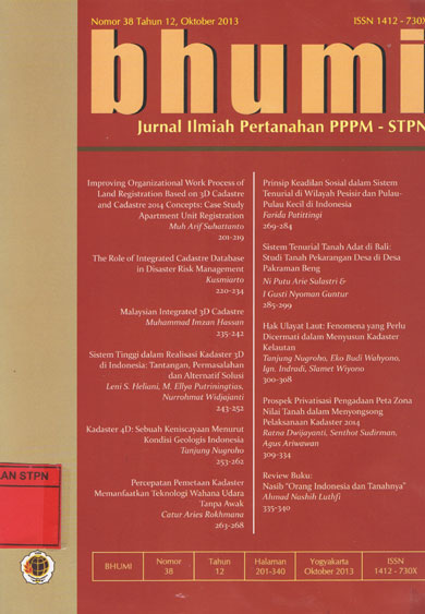 | Improving Organizational Work Process of Land Regristration Based on 3D Cadastre and Cadastre 2014 Concepts: Case study Aoarment Unit Registration = The Roe of Integrated Cadastre Database in Disaster Risk Management = Malaysian Integrated 3D Cadatre = Sistem Tinggi dalam realisasi Kadaster 3D di Indonesia:Tanatangan, permasalahan dan Alternatif Solusi = KadasterD: Sebuah Keniscayaan Menurut Kondisi Geologis Indonesia = Percepatan Pemetaan Kadaster memanfaatan Teknologi Wahana Udara = Prinsip Keadilan Sosial dalam sistem Tenurial di Wilayah Pesisir dan Pulau-pulau kecil di Indonesia = Sistem Tenurial Tanah Adat di Bali Studi Tanah Pekarangan Desa di Bali: Pakraman Beng - 2013 - Jurnal |
 | Majalah Cegis Second quarter issue 1997: Gis Training in Indonesia beyond the theory info the applicatons era through Esri South Asia= Infrastructure Management. - 1997 - Majalah Cegis |
 | Majalah Cegis Vol. 1 No.4 Dec 1997 : One Stop Shop for Gis Training in Indonesia=Indonesia's year 2000 census Promises to be the most Accurate yet= Proven low cost forestry Management= - 1997 - Majalah Cegis |
 | Filosofi Baru Tentang Manajemen Mutu Terpadu (Total Quality Management) Abad 21 - Bumi Aksara - 2002 - Manajemen,Filosofi |
 | Azas-Azas Management - Alumni - 1970 - Manajemen |
 | Bacaan Terpilih Tentang Total Quality Management - Andi Offset - 2002 - Manajemen |
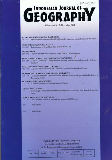 | Indonesian Journal of Geography Volume 46, No.2 December 2014:
Spatio temporal analysis of land use change for supporting landslide exposure assesment; Determination of coastal belt in the disaster prone area; Impacts of land cover change on climate trend in Padang Indonesia; Analysis community's coping strategies and local risk governance framework in relation to landslide; Agricultural loss caused by 2007 Sidoharjo's flood and its house-hold impact; An examination of the determinants of the mode of transport to primary health facilities in a developing region; Characterization of jos city road network, Nigeria; Evaluating the integrated environmental management of munici-pal solid waste in Osaka City, Japan; The livelihood analysis in Merapi prone area after 2010 eruption. - Faculty of Geography Gadja Mada University - 2014 |
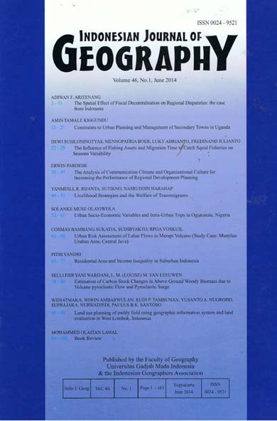 | Indonesian Journal of Geography: The spacial effect of fiscal decentralisation on regional disparaties: the case from Indonesia; Constraints to urban planning and management of secondary towns in Uganda; The influence of fishing assets and migration time to catch squid fisheries on seasons variability; The analysis of communication climate and organizational culture for increasing the performance of regional development planning; Livelihood strategies and the welfare of transmigrants; Urban socio-economic variables and intra-urban trips in Ogun State, Nigeria; Urban risk assesment of lahar flows in merapi volcano (study case: Muntilan urban area, Central Java); Residential area and income inequality in sub urban Indonesia; Estimation of carbon stock changes in above groung woody biomas due to volcano pyroclastic flow and pyroclastic surge; Land use planning of paddy field using geographic information system and lang evaluation in West Lombok, Indonesia - Indonesia Journal of Geographic - 2014 |